As a GIS Instructor, I developed labs, midterms, and final exams. This particular map was the key for the final map practical I created for my students in the Fall 2016.
This map was created using the Least Cost Path Tool in ArcMap 10.4. This tool determines the "cost" of moving through each cell in a raster and finds the path between a starting and ending point that accumulates the least cost.
Tools:
Skills:
raster calculator, least cost path, euclidean distance, feature class to raster
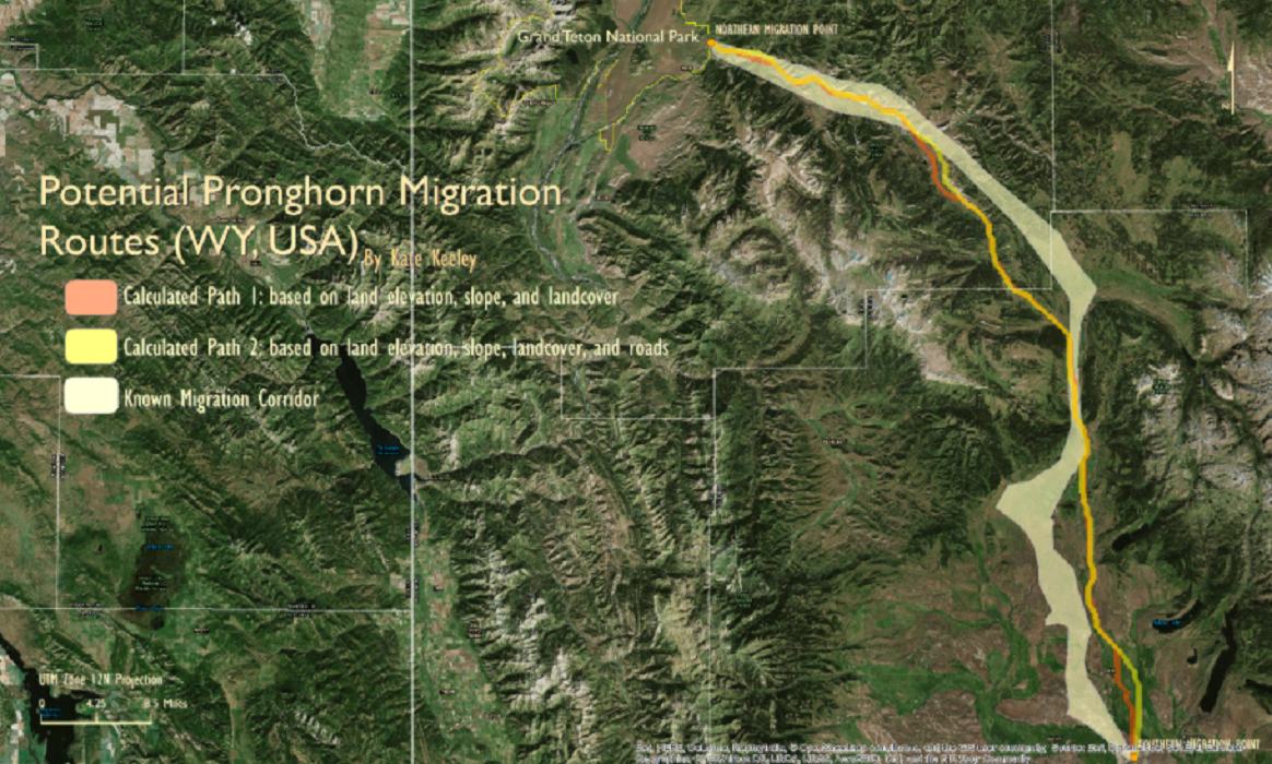
To create this map, the following layers were used:
- Sublette and Teton, WY county boundaries (polygon layer)
- DEM of both counties (raster layer)
- Slope raster for both counties (raster layer)
- Vegetation landcover (raster layer)
- A north and south point for Grand Teton National Park pronghorn migration (point layers)
- Roads (line layer)
- A known migration corridor of pronghorn (used for comparison at the end)
After turning on the Spatial Analyst Extension, I used the Raster Calculator to combine all three raster layers into one raster.
Using the Cost Distance tool, I inputted the north migration point and the output from the raster calculator. Then, using the Cost Path tool, I used the south migration point as the feature destination and the output from the Cost Distance tool as the input raster.
The output was only one raster cell wide, so to make it thicker, I used theEuclidean Distance tool and increased the distance. I wanted to add more information into my model, so I converted my road line layer to a raster layer and repeated the above steps again.