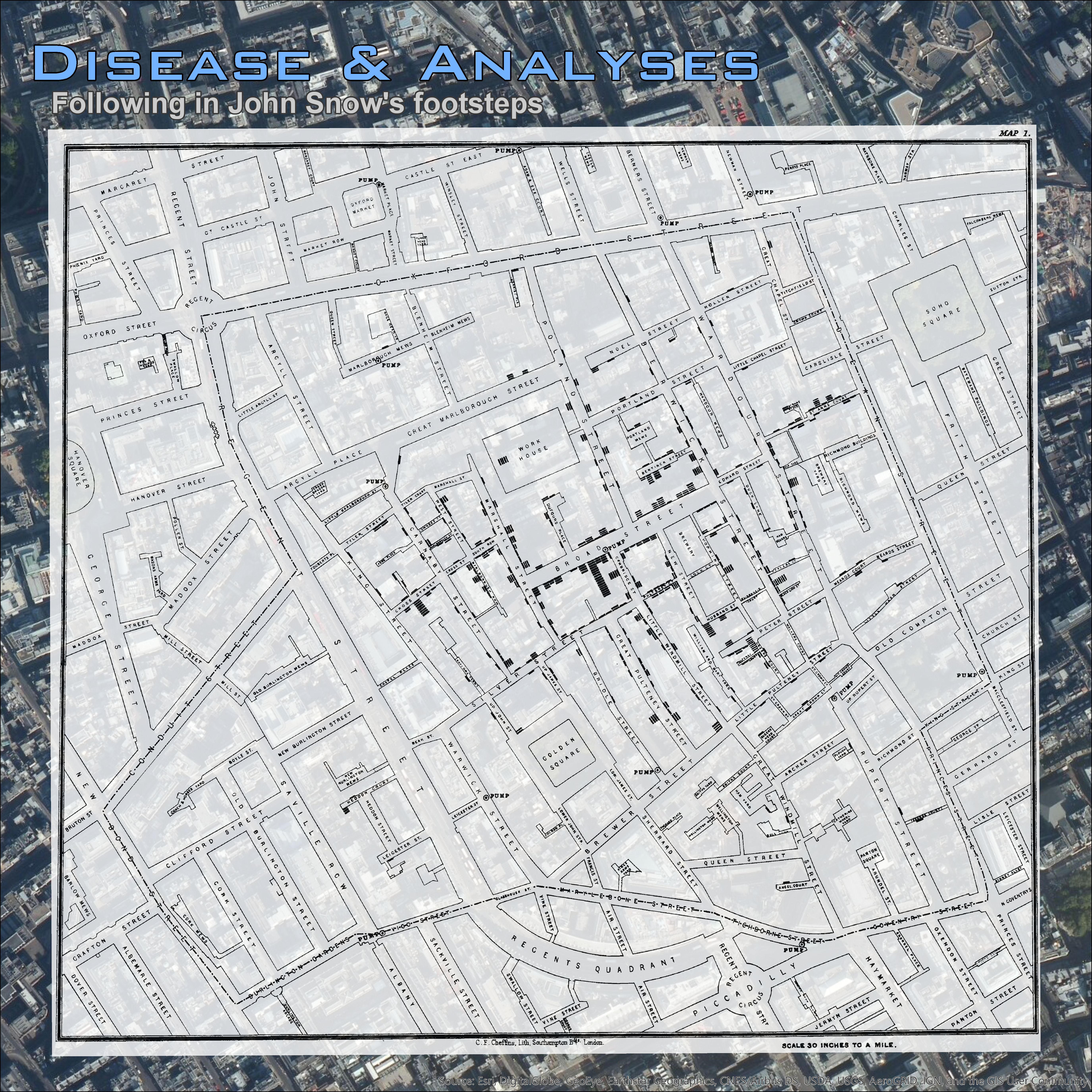
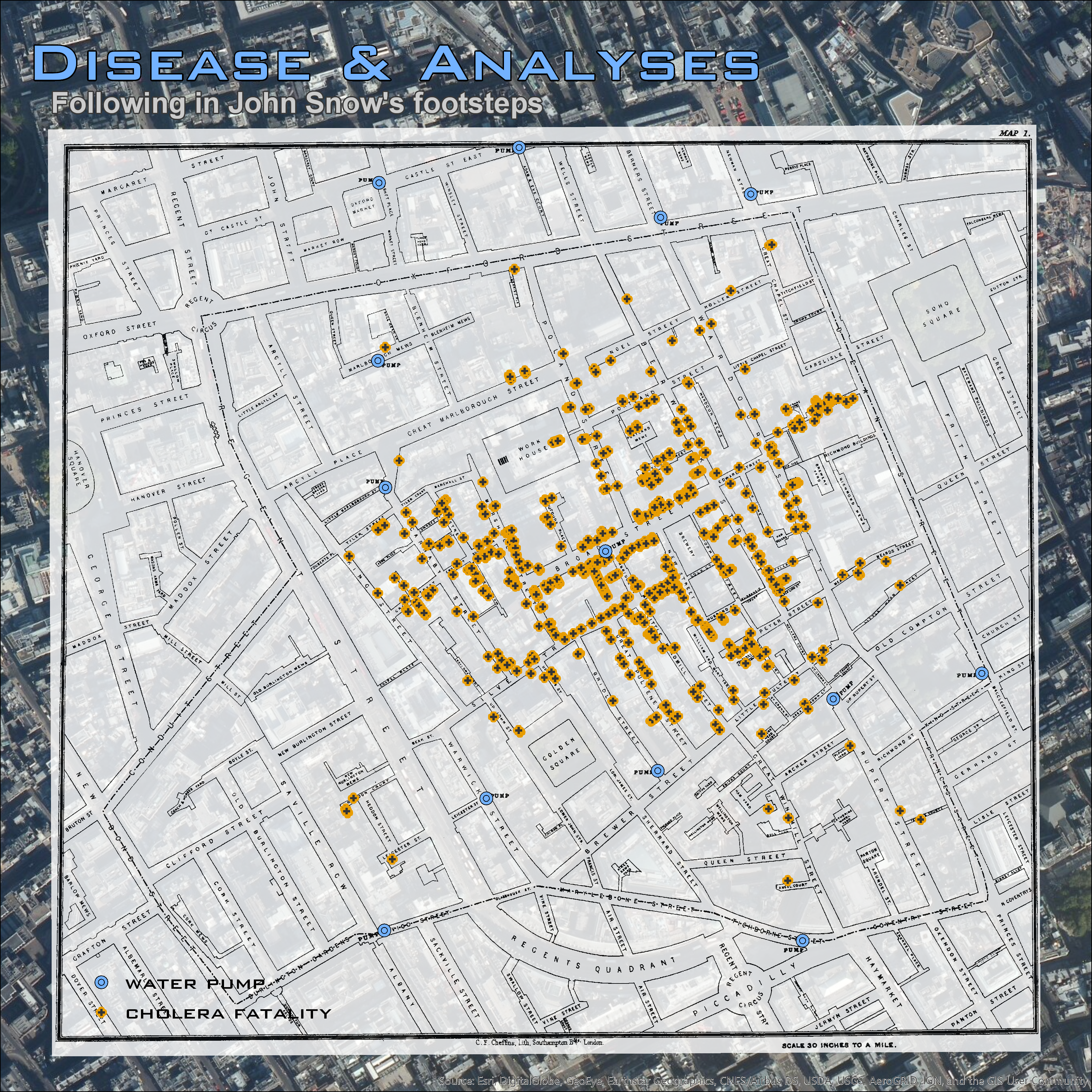
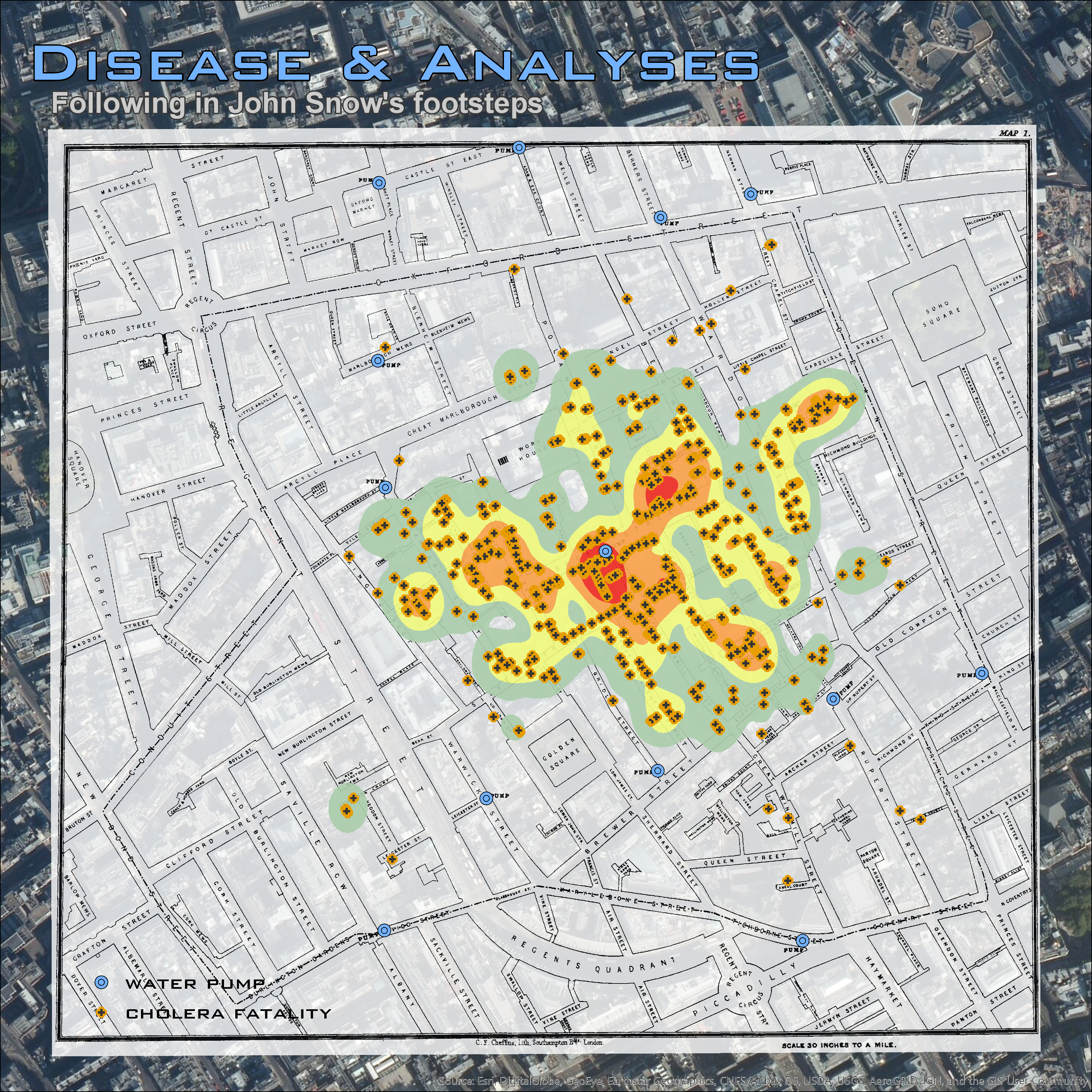
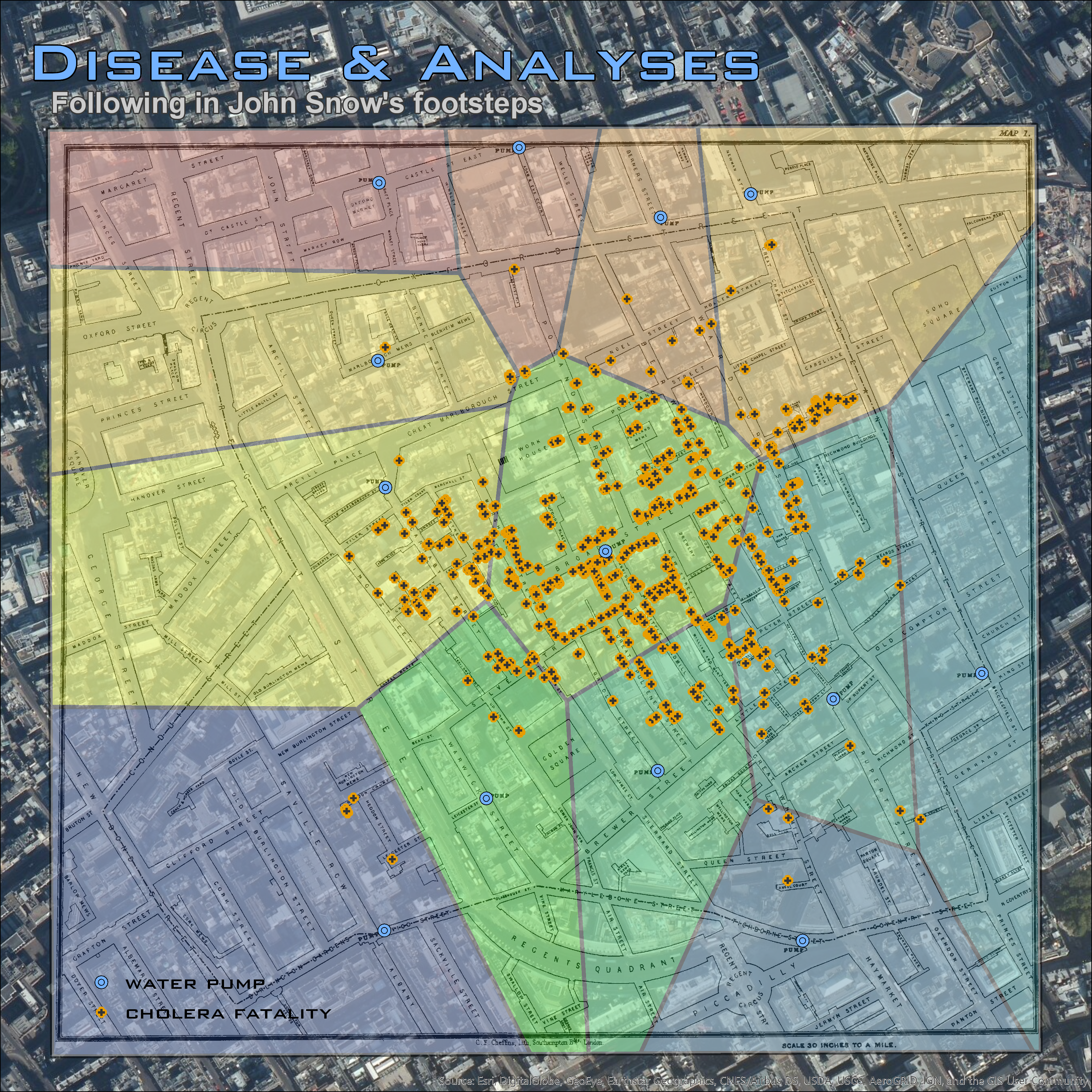
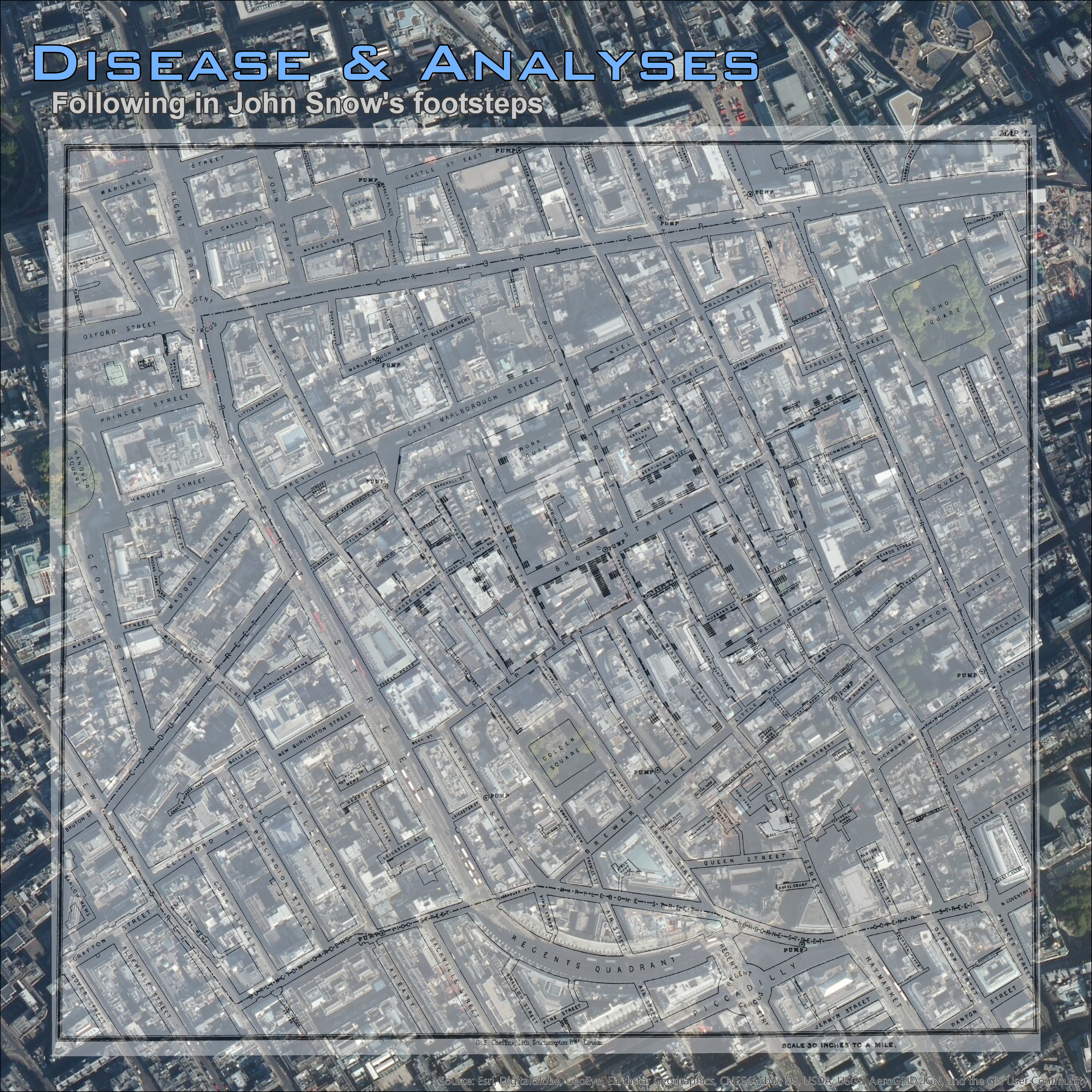
In 1854, Dr. John Snow explored the cholera epidemic and located the source as the Broadstreet water pump using a spatial analysis. Modern day spatial analyses mean we can understand the world like never before. This project followed in John Snow's footsteps...
First, the GISt of It:
The previous video was created using Animation in ArcGIS Pro.
Tools:
Data:
Skills:
georeference, digitization, kernel density, Thiessen polygons, average nearest neighbor analysis
I created several maps to spatially analyze the Broadstreet pump and the cholera epidemic (see pictures below or click on a link for full size image):