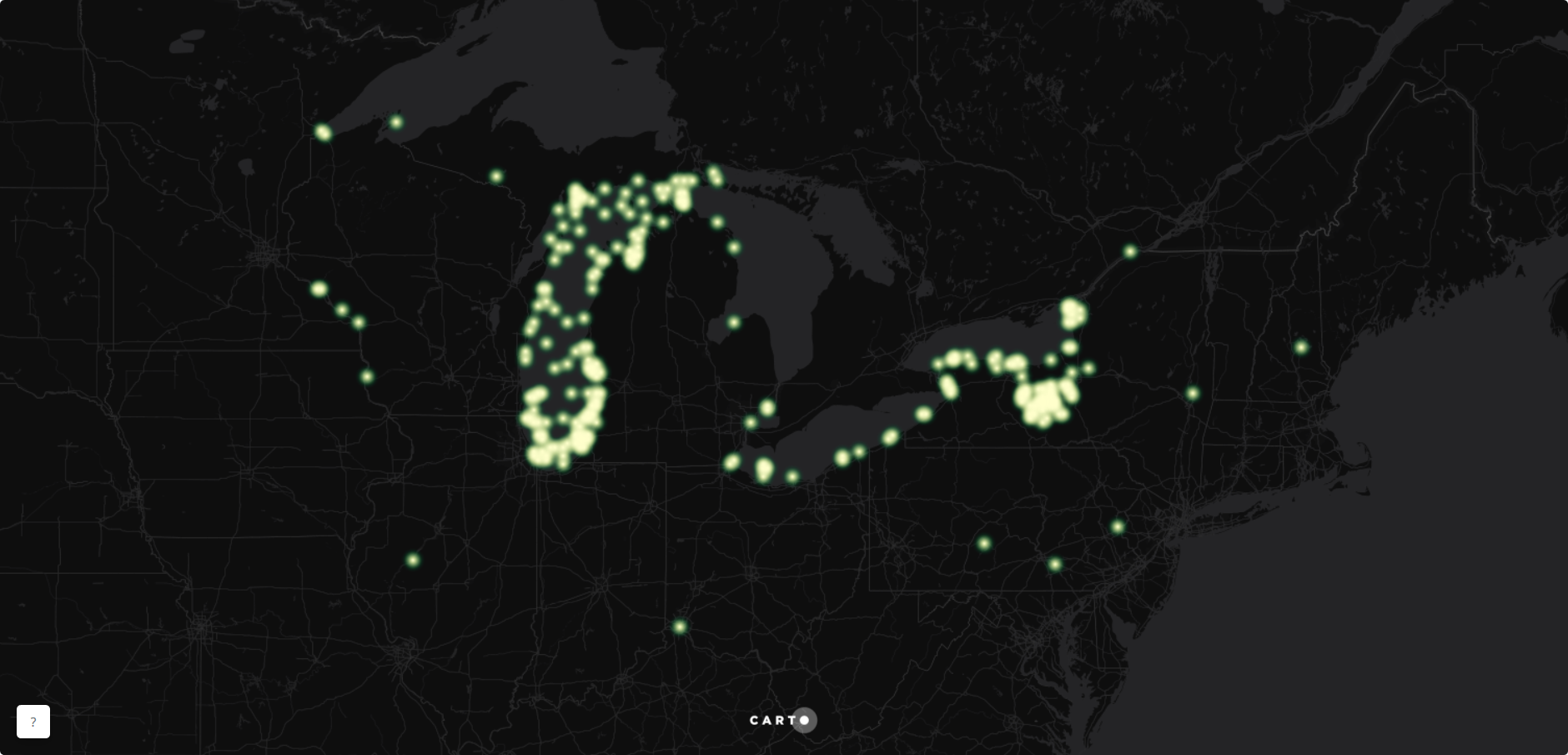
I recently discovered the Great Lakes Aquatic Non-Indigenous Species Information System (GLANSIS), a brilliant database that synthesizes all of the information out there about non-indigenous species. I knew immediately that I had to play around with the data. I’ve been meaning to learn CartoDB, so I thought this was a perfect opportunity to also play with this new mapping platform.
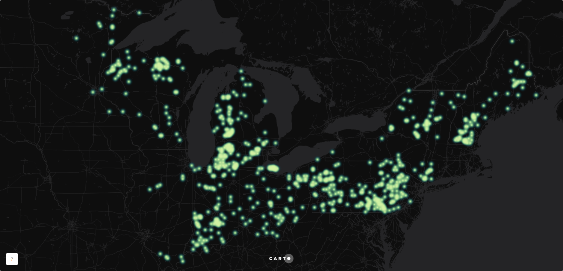
Their map explorer gives you a great glimpse of what data they have. I decided to select five of their “hot button” species and map their extent across the US Great Lakes and St. Lawrence states:
- Freshwater Jellyfish, Craspedacusta sowerbyi
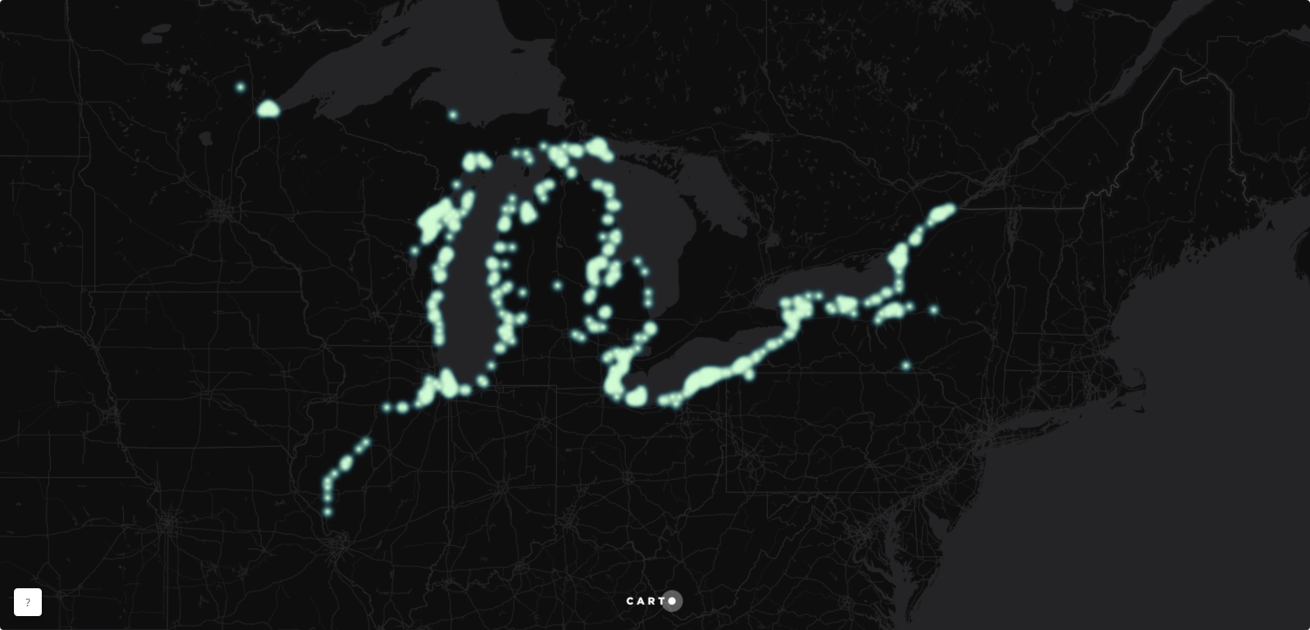
- Quagga Mussel, Dreissena rostriformis
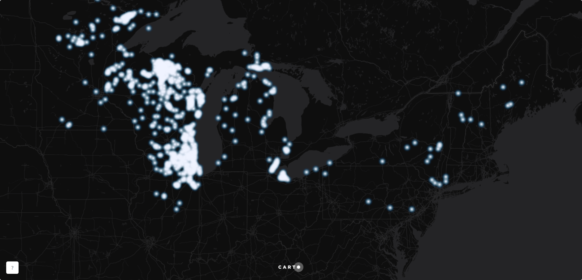
- Round Goby, Neogobius melanostomus
- Rusty Crayfish, Orconectes rusticus
- Zebra Mussel, Dreissena polymorpha
After cleaning up the data, I immediately started figuring out how the time slider worked in CartoDB. Check out my live and interactive version below or by clicking here.
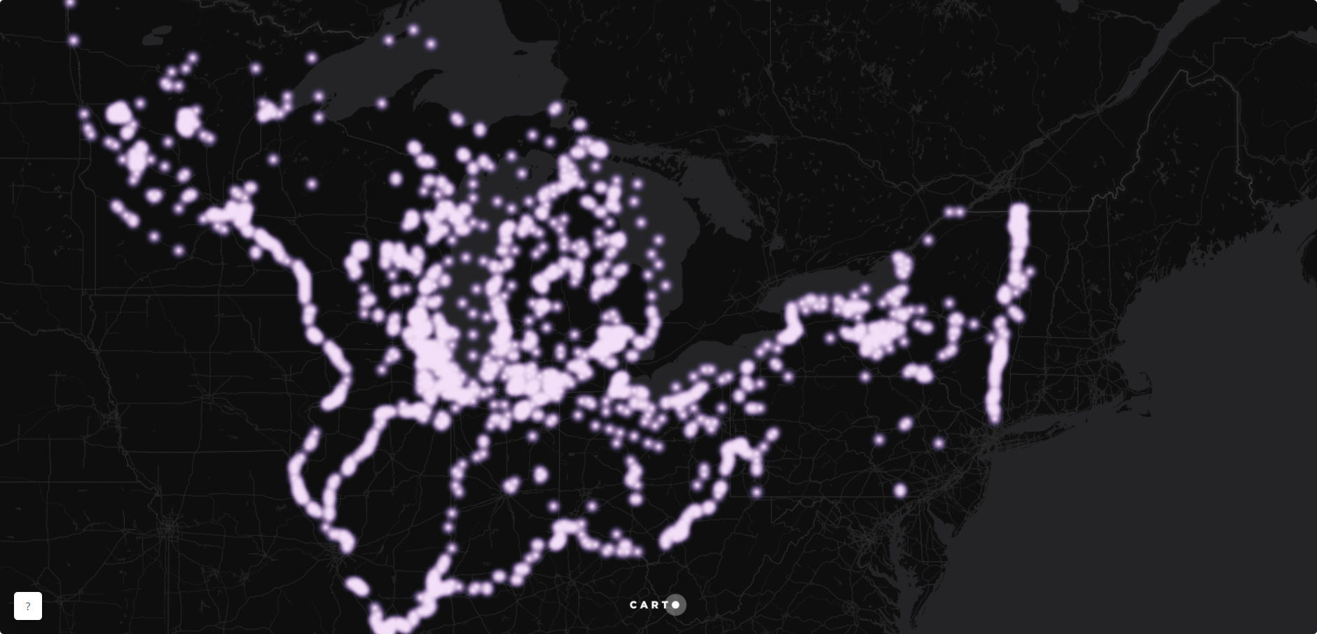
Lastly, in CartoDB, I played with their “calculate clusters of points” tool, where I can “spatially separate a layer of points into a specified number of groups”, and their “find centroid of geometries” tool that “calculates a direct centroid by category”.
I thought it’d be fun to try and identify regions where the Great Lakes Environmental Research Laboratory (GLERL), could divide and conquer their efforts and maybe even set up headquarters for those regions. I asked for five clusters and the “calculate clusters of points” tool spit out the pastel colored point clusters below. The “find centroid of geometries” tool identified the center of each cluster and I aggregated them based on the count of records for each cluster. So, for example, cluster 0 has the biggest circle because that is where there are the most records of non-indigenous species found. Play around with the interactive version of this below or by clicking here.
Happy mapping and be sure to check out all the interesting schtuff that GLERL is doing with the GLANSIS!